Adirondack Geology:
Shaping the Adirondack Landscape
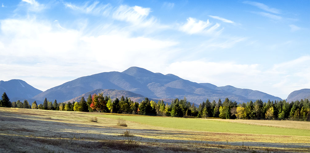
The geologic history of the Adirondacks has two major chapters: the doming of the Adirondacks which created the mountain range, and the subsequent sculpting of those mountains by glaciers during the Pleistocene epoch (Ice Age).
Shaping the Adirondacks: How the Mountains Were Made
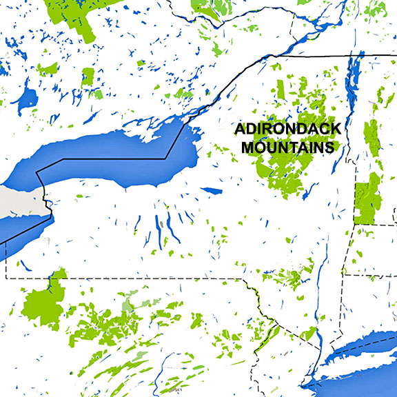
The shaping of the Adirondacks was part of a larger process involving the movement of the earth's tectonic plates. The story is a complex one, involving the coming together and breaking up of continents and the appearance and later closing of ancient oceans.
- The oldest rocks in New York State – part of what is called the Grenville Province – were deposited around 1.3 billion years ago in shallow seas.
- Around a billion years ago, these rocks were involved in a continent-continent collision, called the Grenville Orogeny, which produced a high mountain range and plateau. Over the following 400 million years, these mountains and plateau – now part of one supercontinent – were eroded to flat lands. About 660 million years ago, this supercontinent began breaking apart, gradually producing what is called the Iapetus Ocean.
- Between 650 and 600 million years ago, the crust in the eastern portions of what was later to develop into the North American continent was stretched and was broken by major faults. These faults run north-northeast throughout the eastern Adirondacks.
- About 550 million years ago, a long volcanic island arc formed in the Iapetus Ocean and then collided with what was later to become North America. This collision, known as the Taconian Orogeny, created a mountain range (the Taconic Mountains) that extended from what is now Newfoundland to Alabama. The remaining part of the Iapetus Ocean closed, an event known as the Acadian Orogeny.
- About 330 to 250 million years ago, another continental collision occurred -- the Alleghanian Orogeny, which build the Appalachian Mountains. Eventually, all of the earth's continental crust was again joined in a supercontinent called Pangea.
- The Pangea supercontinent began breaking apart about 220 million years ago. As Africa separated from North America, the rift in between widened into the Atlantic Ocean.
- Some twenty million years ago, for reasons which remain obscure to geologists, a dome about 150 miles across – later to become the Adirondack Mountains – began to rise. Erosion ensued, creating a system of parallel valleys, wearing away the sediments on the surface, and exposing the billion-years-old rocks below. The Adirondacks are continuing to rise at an estimated rate of about a foot per century, assuming that the current rate continues.
The Adirondacks – the product of this lengthy process – are a unique mountain range. They are not part of the Catskills or Appalachian Mountains. They are new mountains, although made of old rocks, and are still growing, faster than erosion is wearing the surface away.
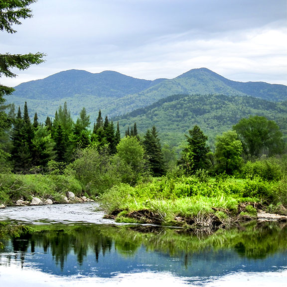
This complex process accounts for some of the landscape features we see today.
- The north-northeast faults in the eastern Adirondacks resulted in long, straight valleys that run north-northeast, some containing lakes such as Lake George, Schroon Lake, Indian Lake, and Long Lake. Within the High Peaks region of the Adirondacks, these valleys divide the area into a number of long, straight mountain ranges.
- In the central and southern Adirondacks, there are more gently-curved ridges and valleys which follow the layering of folded rocks, making an east-west arc.
- The Adirondacks is characterized by a radial drainage pattern, with streams and rivers flowing outward toward the edge of the dome, in some cases following the dominant north-northeast valleys. The Ausable and Saranac rivers, for instance, flow north, draining into the St Lawrence via Lake Champlain, while the Schroon River flows south, draining into the Hudson.
Shaping the Adirondacks: Sculpted by Glaciers
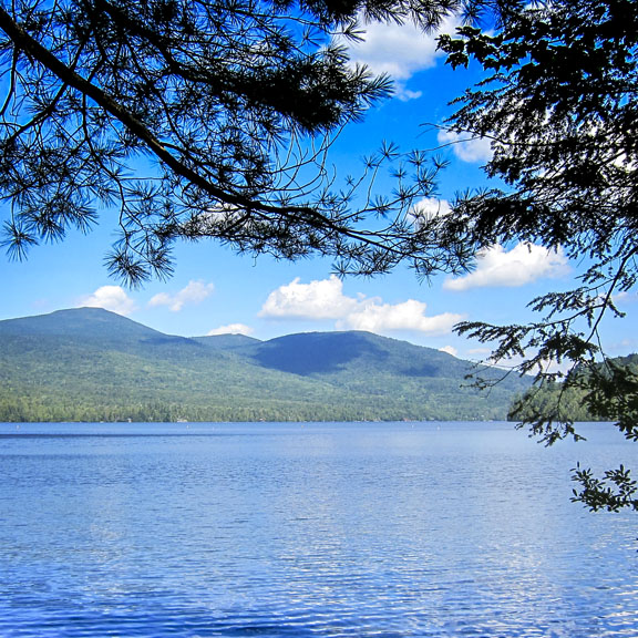
The second series of events to shape the Adirondack landscape began much more recently, about 1.6 million years ago, when cooling climates around the world led to the repeated advance and retreat of huge ice sheets in the northern hemisphere. This era is known as the Pleistocene Epoch or (more popularly) the Ice Age.
- The last advance of these ice sheets – the Wisconsin glaciation – began some 80,000 years ago and reached its maximum extent in New York State around 21,000 years ago.
- As it advanced, the glacier sculpted the landscape, scraping away soil and loose sediment, wearing down bedrock, carving river valleys, depositing rock debris, and rounding off the Adirondack peaks.
- Then, temperatures gradually warmed, and the ice sheets began a northward retreat, known as the Wisconsin deglaciation. The retreat of the glacier also produced notable changes in the landscape. For instance, as it melted, the Wisonsian ice sheet released huge volumes of meltwater. In places where glacial debris had dammed valleys, meltwater lakes were formed. Some, like South Meadows Lake near Lake Placid, have long since drained.
The Adirondacks' glacial past is evident in wide range of topographic features and glacial landforms:
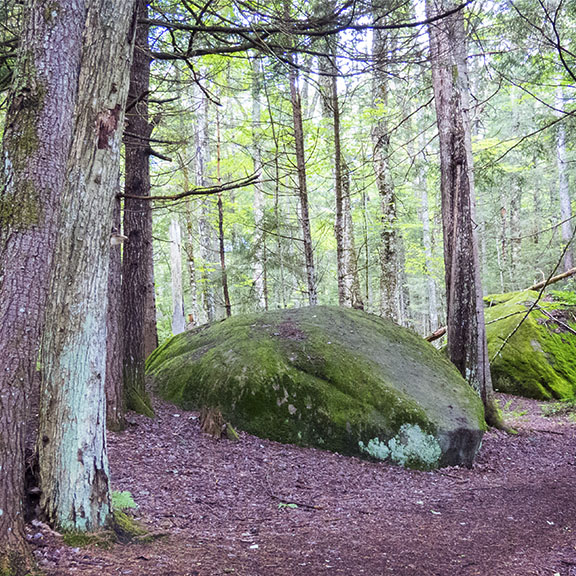
Glacial Erratics:
Glacial erratics are the stones and rocks that a glacier picked up as it advanced and then left behind as it melted. Glacial erratics can be carried for hundreds of miles and may differ significantly from the rocks native to the area in which it rests. The term "erratic" comes from the Latin "errare," which means "to go astray." Glacial erratics can be seen along many trails throughout the Adirondacks.Eskers and Kames:
An esker is a long, usually winding ridge of gravel and other sediment deposited by meltwater from a retreating glacier. Meltwater streams, flowing under and within the glacier through tunnels in the ice, created stream beds from rock material embedded in the glacier. After the glacier melted, these riverbed sediments were deposited on the landscape as winding ridges called eskers. Eskers, which can be several kilometers long, are common in the Adirondack Mountains. Many lie along the shores of Adirondack lakes or project into the lake from the shore. Examples include Saranac, Tupper, Rainbow, and Cranberry Lakes.One of the most convenient places to observe an esker is the Black Pond Trail at the Paul Smiths VIC. Black Pond is a 72-acre glacial pond whose western boundary is an esker. The Black Pond Trail skirts the western shoreline of Black Pond, between the esker and the pond. Black Pond, a glacial pond originally formed by meltwater from large chunks of ice embedded in the retreating glacier, will be on your right, while the esker will be on your left.
A kame is a steep-sided mound of sand and gravel. When sediment-laden water flowed over the glacier's surface, it filled depressions with sand and gravel. As the glacier melted, material from circular depressions was deposited on the landscape as mounds called kames.
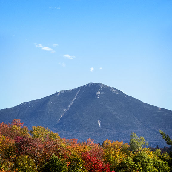
Cirques and Aretes:
A cirque is a concave, circular basin carved by the base of a glacier as it erodes the landscape. In the Adirondacks, as the main continental glacier retreated, smaller mountain glaciers remained in highland areas. These alpine glaciers carved river valleys and steepened the valley walls, creating cirques. An arete is a thin ridge of rock formed where the tops of cirques joined.An examples of a cirque in the Adirondack Mountains is the west-facing valley of Giant Mountain; this cirque continues to erode as massive rock slides expose its steep walls. Cirques are also responsible for the distinctive shape of Whiteface Mountain. Three separate alpine glaciers carved cirques on the east, west, and north sides of the mountains. The ridges where the cirques meet form aretes. If the alpine glaciers had persisted, the cirques on Whiteface would have ended up back-to-back, leaving a horn; and Whiteface Mountain would now look like the Matterhorn in Switzerland.
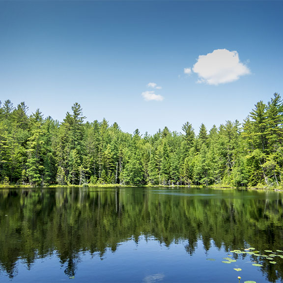
Kettle Holes and Kettle Ponds:
Kettle holes, kettle hole lakes, and kettle ponds are common in the Adirondacks. They were formed as the glacier melted, leaving behind massive ice blocks, which were buried beneath accumulating sand and gravel washed from the ice. As these buried ice blocks melted, the sediments on top of them slowly sank to the bottom of the depression, leaving behind kettle holes.When a kettle hole formed below the water table, a kettle pond or lake was created. Kettle hole lakes and ponds are oval or circular in shape, lack an obvious inlet and outlet stream, and are fed by rainwater and a high water table. Many of the small, circular ponds and wetlands in the Adirondacks were created in this fashion. Examples include Ice House Pond and Helldiver Pond in the Moose River Recreation Area, as well as Simkins Pond and Cooler Pond near Paul Smith's College.
References
Y.W. Isachsen, et al Geology of New York: A Simplified Account. Second Edition (The University of the State of New York, 2000), pp. 68-103, 301-340.
Jerry Jenkins. The Adirondack Atlas: A Geographic Portrait of the Adirondack Park (Syracuse University Press & the Adirondack Museum, 20014), pp. 8-13.
Bradford B. Van Diver. Roadside Geology of New York (Mountain Press Publishing Company, 1985), pp. 6-39, 299-387.
Howard W. and Elizabeth B. Jaffe Geology of the Adirondack High Peak Region: A Hikers Guide (The Adirondack Mountain Club, 1986).
James Ryan. Adirondack Wildlife: A Field Guide (University of New Hampshire Press, 2008), pp. 3-6.
James McLelland and Bruce Selleck, "Geology of the Adirondack Mountains. Like an Egg with Its Major Axis to the North," William F. Porter, Jon D. Erickson and Ross S. Whaley. The Great Experiment in Conservation. Voices from the Adirondack Park (Syracuse University Press, 2009), pp. 19-32.
Georg Wolfgang Fuhs et al. Restoration of Lower St. Regis Lake, Franklin County, New York (Environmental Research Laboratory. Office of Research and Development. U.S. Environmental Protection Agency, 1977. Retrieved 5 October 2015.
National Snow & Ice Data Center. All About Glaciers. Retrieved 5 October 2015.
New York State Adirondack Park Agency. Geology of the Adirondacks. Retrieved 2 October 2015.
